I just came back from a day of bush walking in a so-called “remote area” of Mount D’Aguilar, Queensland, where the wreck of the Piper Comanche VH-GAS remains. This post details a bit the trek to the crash site and details the accident that occurred on March 2, 1977.

To reach the VH-GAS wreck, start from the parking area at the junction of Mount Glorious Road and Lepidozamia Road. Walk along Lepidozamia Road for 50 meters and go right into the trail entrance, which is very easy to miss. The trail descends steeply to the wreck site, located at -27.2996901, 152.7742886. The hike is steep and can be slippery, so use a GPS track and watch for markers. The round trip takes around 2 hours.
Background on VH-GAS
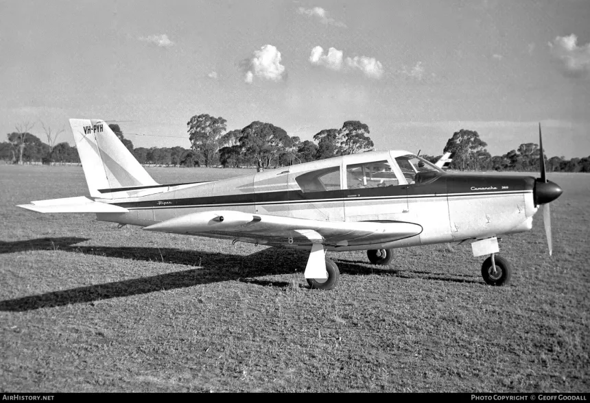
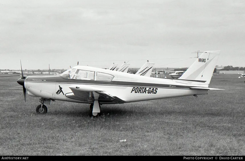
The Piper Comanche, initially registered as VH-PYH, was later re-registered as VH-GAS. Its role evolved to transporting gas cylinders across Australia, marked by the distinctive “PORTA-GAS” paint on its fuselage.
Details from the Crash Report
On March 2, 1977, the aircraft departed Harrison’s Pocket with the intention of reaching Redcliffe. However, adverse weather conditions led the pilot to encounter severe challenges. The aircraft entered cloud cover and, tragically, collided with the Mount D’Aguilar mountain range. The impact sent the plane through trees before it came to a stop, inverted, on the mountain’s slope.
The official investigation into the crash, documented under investigation number 197700003, revealed several critical points:
-
Flight Path and Weather Conditions: The aircraft initially departed Harrison’s Pocket and faced deteriorating weather conditions as it approached Brisbane. After being denied Special VFR clearance to enter the Archerfield Control Zone, the pilot attempted to navigate through worsening weather. Despite obtaining clearance later, the visibility and cloud cover made navigation extremely difficult.
-
Accident Sequence: As the aircraft proceeded at low altitude, it flew into an area of rising terrain under challenging weather conditions. The combination of low cloud cover and poor visibility led to the aircraft striking a tree and crashing on Mount D’Aguilar.
-
Pilot’s Experience: The pilot had demonstrated competent manipulative skills but was restricted to flying only in Visual Meteorological Conditions (VMC) due to color blindness. This limitation was a significant factor in the accident, as the pilot continued the flight into Instrument Meteorological Conditions (IMC) where visibility was poor.
-
Investigation Findings: The final report concluded that the accident was caused by the pilot’s persistence in flying under hazardous conditions. The combination of adverse weather, low visibility, and challenging terrain contributed to the fatal outcome.
Read original crash report in PDF


Conclusion
Tough walk, steep as hell, but worth it. Standing next to what’s left of VH-GAS almost 50 years after it crashed into that mountain is something else. The crash report makes it clear: bad weather, a pilot who pushed his luck, and a mountain that didn’t move.

If you’re thinking about doing this walk, bring a GPS, wear decent shoes, and don’t go after rain. It’s remote and it’s slippery.